Marker Project 2015 || Team Members: Annisa Rizal, Maurishka Sahani, Alex Le, Christopher Tee || Role in project: Create and prepare terrain for renders | http://markerproject2015.pbworks.com/
As a group, we've decided to focus on the development of areas in the virtual environment which will be of greater value. This means that we will only be developing the M7, M7 exits and the route to the Blacktown International Sports park in higher quality compared to the roads which don't relate to our network of markers.
This image is the starting stages of elevating the main roads and placing onto the terrain. The colours represent the three main highways.
Red : M7 (Main focus)
Blue: M4
Orange: Great Western Highway
The bottom part of the image illustrates the elevation of each highway. The next step is to integrate Wallgrove road, which is right next to the M7 and branches off to intersect into the Great Western Highway.
As a group, we've decided not to stick with one marker, but plan to create multiple markers, which indicates and enhance the directional cues towards The Blacktown International Sports Park. Each member of the group has been assigned a particular task. The tasks assigned to each members are:
Chris Tee: Prototype
Alex/Annisa: Modelling
Maurishka: Design Concepts and creating the ''Conflict" powerpoint
Jeremy (myself): Topography
I've been assigned to create the virtual context of the site.
Alex has recommended to use a grasshopper plug-in named "Elk". Elk uses two topographic and map platforms from OpenStreetMap.com. The website contains maps with road presets, distinguishing highways from major and minor roads. Elk uses this information to plot points onto grasshopper, keeping with its respective elements of highways, highway exits, major roads and minor roads.
As a group, a few concepts were made to strengthen the underlying representations of what our marker will be. Concepts will be layered within all aspects of the marker. This includes the whole journey from the M7 to The Blacktown Sports Park.
The first layer of the concept is not represented through the marker, but the movement of the journey to the Sports Park. This will be represented by the trajectory of a boomerang, a traditional hunting weapon used by the Australian Aboriginal. (Also used as the logo for The Blacktown Sports Park to represent the return of the community into the sports park.) The location of The Blacktown Sports Park does not directly correspond with any M7 exits. Commuters must make an exit at either Wallgrove Rd or The Great Western Highway from the M7 and drive north towards the Sports Park. This pathway somewhat mimics the trajectory of a boomerang where commuters must turn back after exiting the M7 to get to the sports park, which also represents the "come back"of the community into sports.
(Blue - Sports Park// Red - Exits from M7)
As the collaboration continues, more conceptual layers will be added onto the project.
Reference:
n.a, (2015), Blacktown International Sports Park [ONLINE]. Available at: http://www.internationalgoalkeepers.com/images/BISP%20sm.jpg [Accessed 03 May 15].
The following is a collaboration of research into the ideas that would influence the outcome of the whole project. The information gathered must also relate with the theme of "Mobility" and somehow incorporate it into our own.
AIM: Exploring cutting edge design solutions for a marker that indicated the existence of the Blacktown International Sports Park from the Marker Project Meeting
#1 Lightpole/network
Through site visit, the tall light posts from the sports park played a major role in finding the way to the park. Somewhat change the design of the light post to contrast the landscape.
Idea 1: The secondary lights of the light pole (does not affect the lighting of the playing field) responds to the cars from the M7, which has fixed sensors. (Indicates mobility).
Idea 2: There are multiple markers set on the route towards the sportspark e.g. a bus stop designed with two boomerangs – followed by a a street light pole redesigned and orientated to point towards the sports park located a hundred meters down the road.
#2 Architectural QR on M7
Inspired and suggested by Russell, the group has researched into the development of a 3D QR code which can be scanned from the M7. Influenced by the increasing and rapidly changing development of technology, the idea seemed viable. However, after a bit of discussion with the group members, a 3D QR code on the M7 may end tragic due to the possibility of the driver attempting to scan the 3D QR themselves on a moving vehicle.
#3 Kinetic Architectural Marker
Kinetic Architecture is a direct visualization of "mobility" through the responsiveness of the architecture to a moving element. Examples include the distorting facade of the Brisbane Airport Parking Garage by Ned Kahn and UAP, where the facade consists of thousands of little panels that swivel and move as a response to the wind passing through. The second example Windswept by Charles Sowers conveys the same idea; by using the wind as a kinetic factor which manipulates the facade.
The manipulation of Kinetic Architecture greatly depends on the current environment of where the marker will be placed. From personal experience and the site visit, the environment of the site was not very windy.
#4 Anamorphic Markers
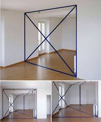
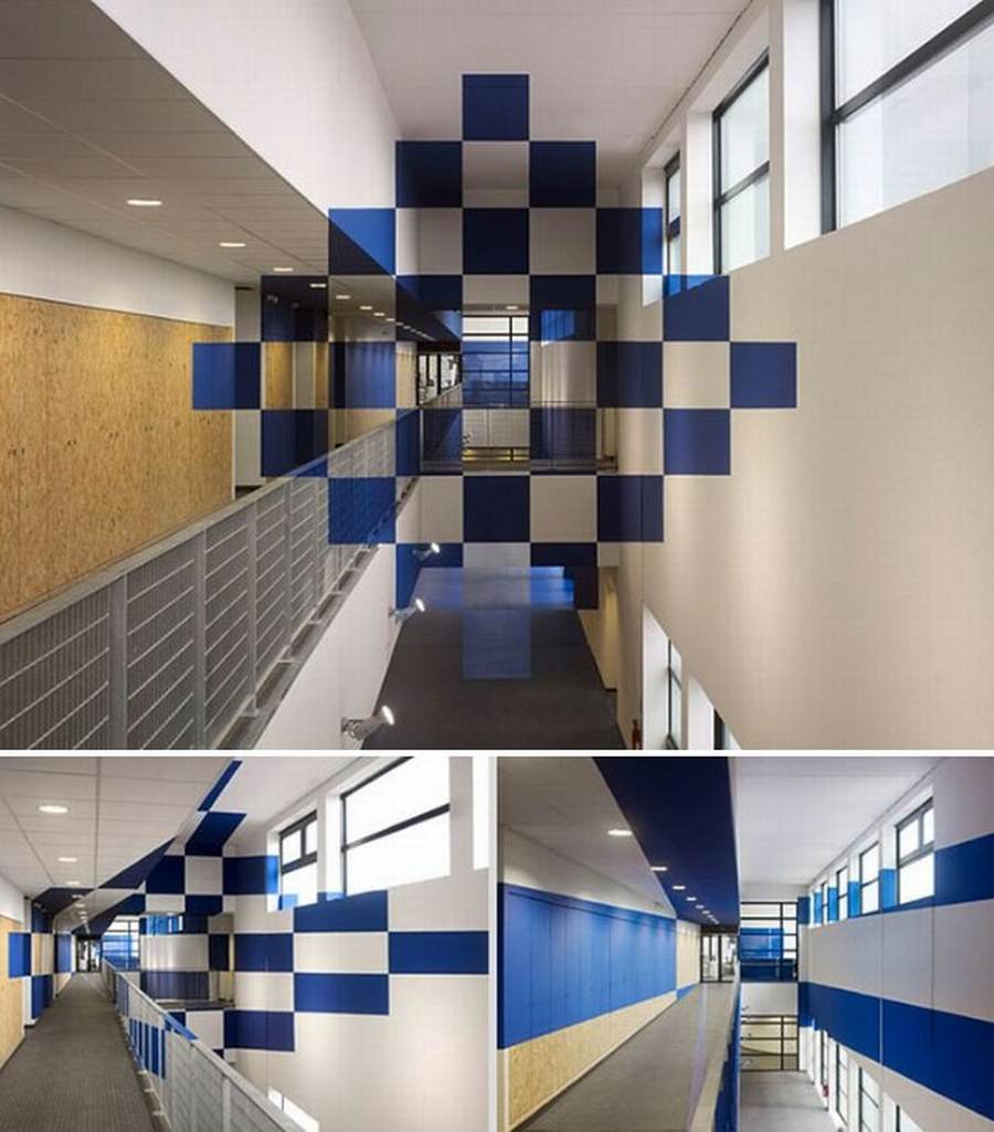
Anamorphic markers are objects/illustrations strategically placed to create an illusion of a regular object, shape or pattern when viewed at a specific angle.
This is an idea which may be integrated into our project through the manipulation of a viewers perspective. This may link to the idea of way-finding where the perfect angle at a certain spot on the journey to The Blacktown Sports Park indicates the right way.
References: Dezeen, (2012), WINDSWEPT [ONLINE]. Available at: https://s-media-cache-ak0.pinimg.com/736x/17/f9/32/17f93276b731a0abb314ddd3bbdf2704.jpg [Accessed 01 April 15]. Entech Creative, (2012), Creative Bus Stop [ONLINE]. Available at: http://qe1pr67o4hj19lx494tvhiwf.wpengine.netdna-cdn.com/wp-content/uploads/2012/01/orlando_bus_stop_02.jpg [Accessed 01 April 15]. Felice Varini, (2014), Perspective [ONLINE]. Available at: https://s-media-cache-ak0.pinimg.com/736x/18/a6/8d/18a68d898d1869422ffc4bc994b6413e.jpg [Accessed 01 April 15]. Felice Varini, (2014), Anamorphic Illusion [ONLINE]. Available at: https://s-media-cache-ak0.pinimg.com/736x/12/36/96/123696ee4bf3299171c38a01424105bc.jpg [Accessed 01 April 15]. n/a, (2012), Sports Lights [ONLINE]. Available at: https://nuvolo.files.wordpress.com/2009/06/yggdrasil2_01.jpg?w=510 [Accessed 01 April 15]. UAP, (2012), brisbane airport kinetic parking garage facade by ned kahn + UAP [ONLINE]. Available at: http://www.designboom.com/weblog/images/images_2/rodrigo/09_september_2012/01_kineticFacade/airport_02.jpg [Accessed 01 April 15].
The marker project members are Alexander Lee, Annisa Rizal, Christopher Tee, Maurishka Sahani and myself. A short aim was provided by Russel Lowe (Lecturer/Tutor) and Nicole (Tutor) where we are to create a "marker" to point out the existence of the Blacktown Sports Park from the M7. The group members and myself took the time to experience the context of the sports park first hand.
Alex, who lives in the Castle Hill area, documented his journey coming down from the north end of the M7 to The Blacktown Sports Park. Annisa, Chris and Myself drove from the South end of the M7 and also documented our journey to The Sports Park. As we gathered and shared information about the journey we found:
1. There were very limited signage and sense of direction to The Sports Park from Alex, Annisa, Chris and Myself.
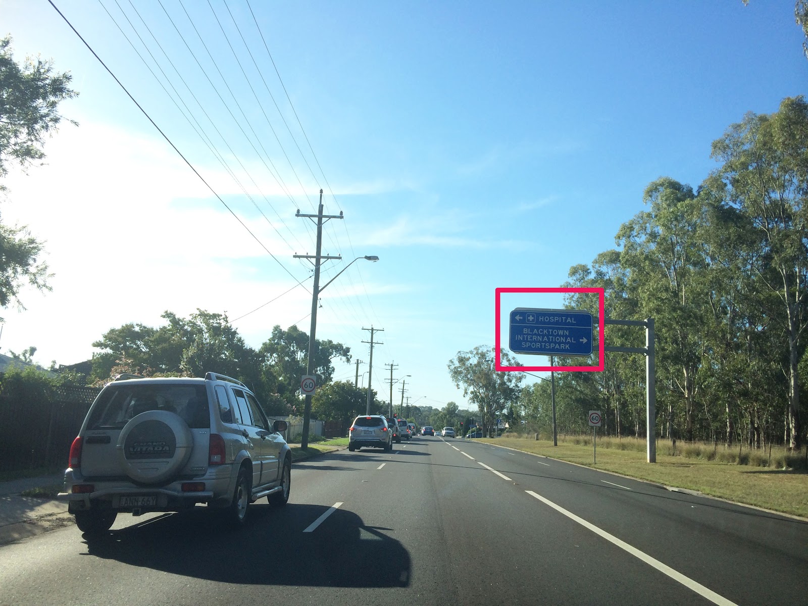
2. As Annisa and Myself drove in the general direction towards the sports park, we found that the only sense of directions are through a few minute road sign and the tall sports park lights.
Great Western Highway/Wallgrove RdEastern Rd/South Rooty Hill RdSouth Rooty Hill Rd
*Images shown are of my own, edited by Annisa Rizal
After the site visit, Alex was able to grab documentations on the restrictions of building around the M7 motorway, which came in handy with the potential placement of the marker.
Due to our group members residing in different parts of Sydney, the only way to consistently collaborate for this project is through:
Skype - Live communication through speaking in a conference call
Facebook Group/Page - An informal online medium to share any information gathered
Google Docs/Presentation - An online medium where information is gathered which, are of a higher standard and quality compared to Facebook


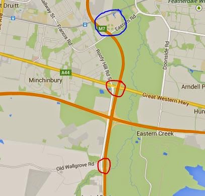


 Great Western Highway/Wallgrove Rd
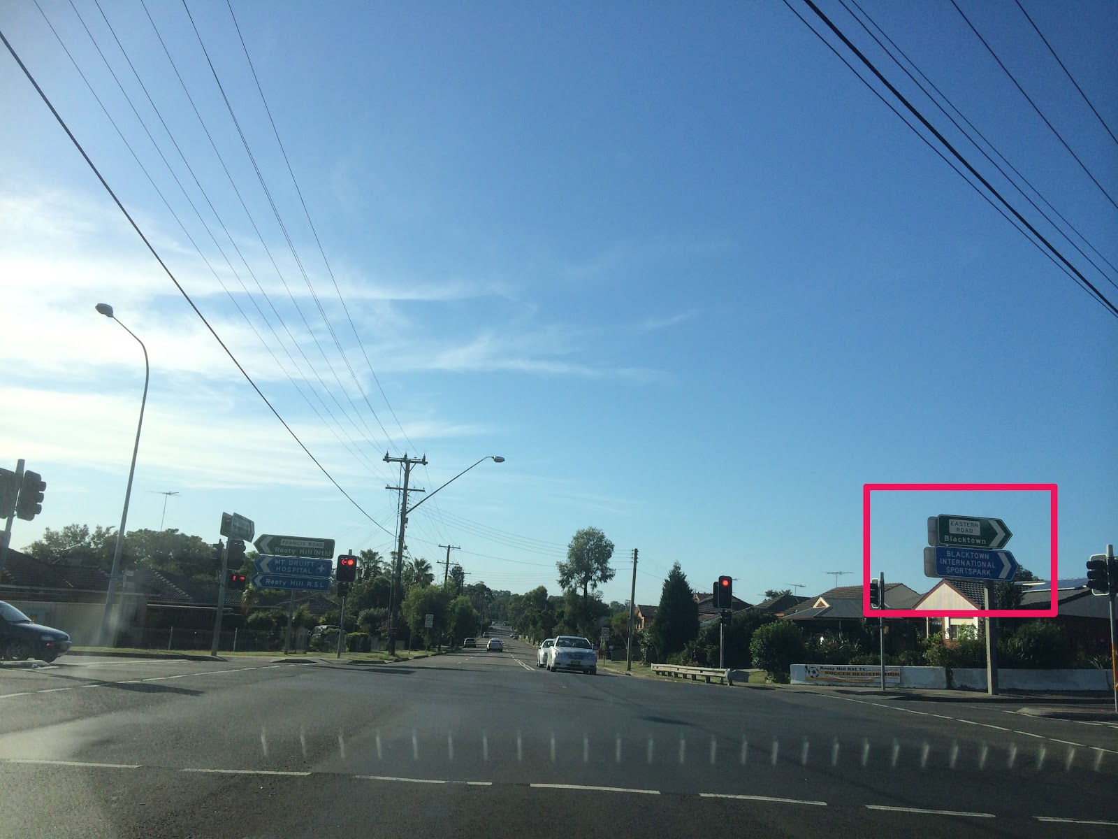 Eastern Rd/South Rooty Hill Rd
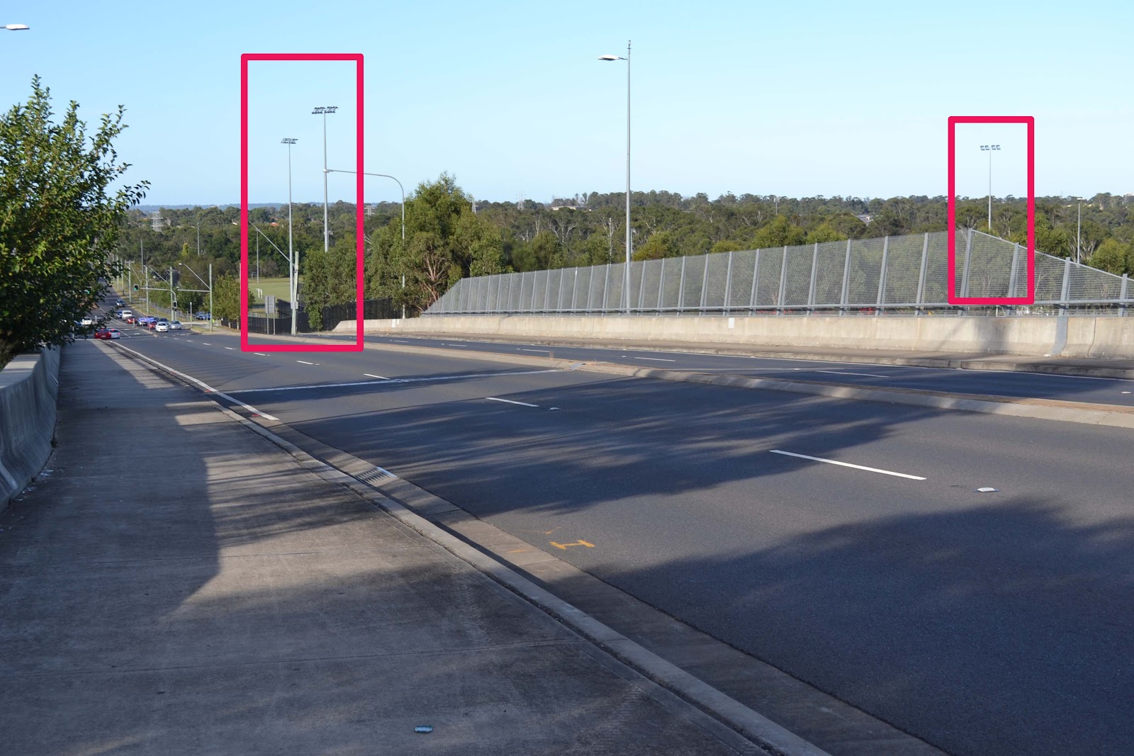 South Rooty Hill Rd